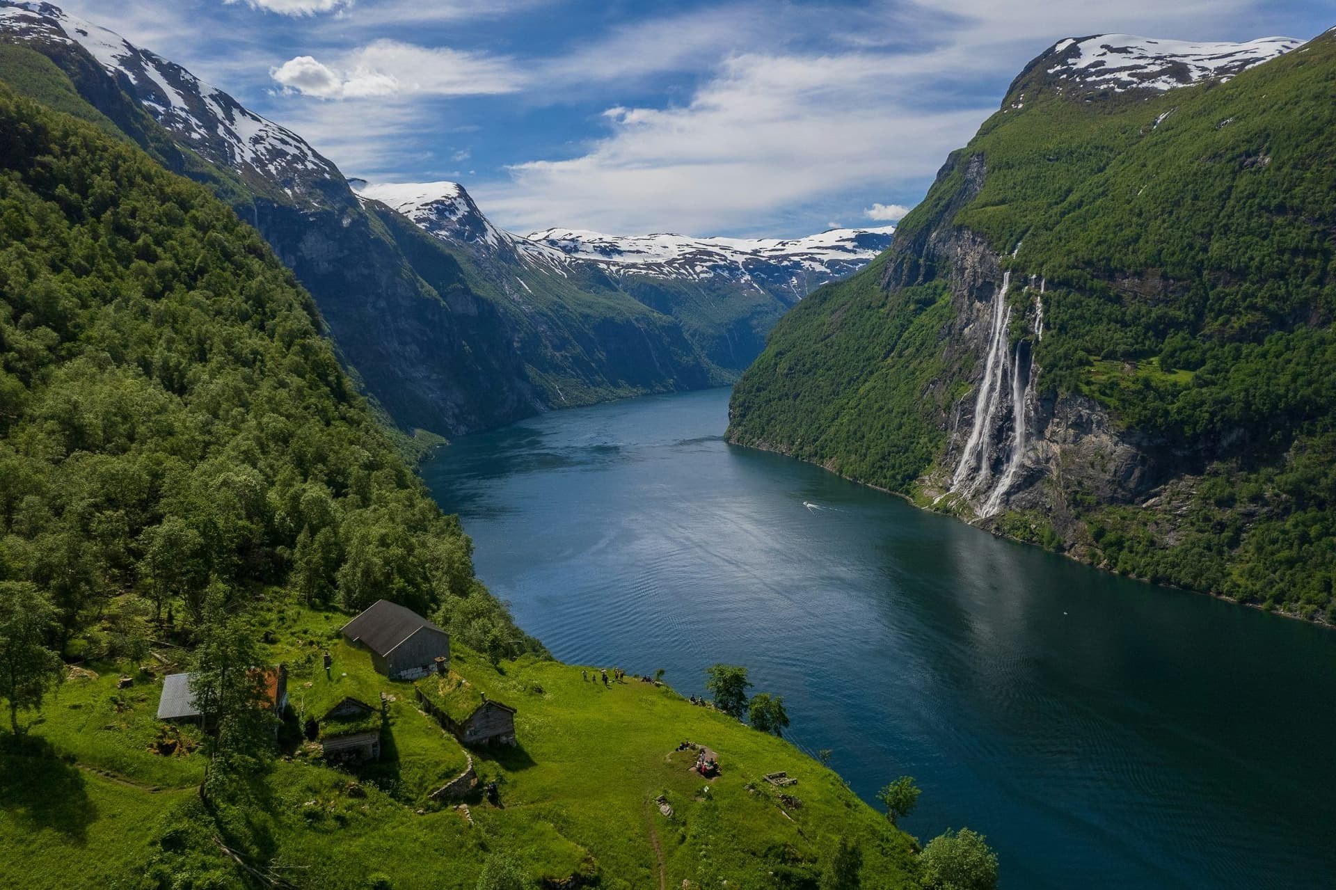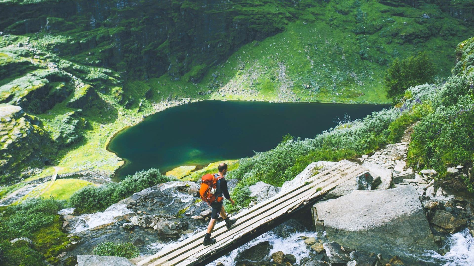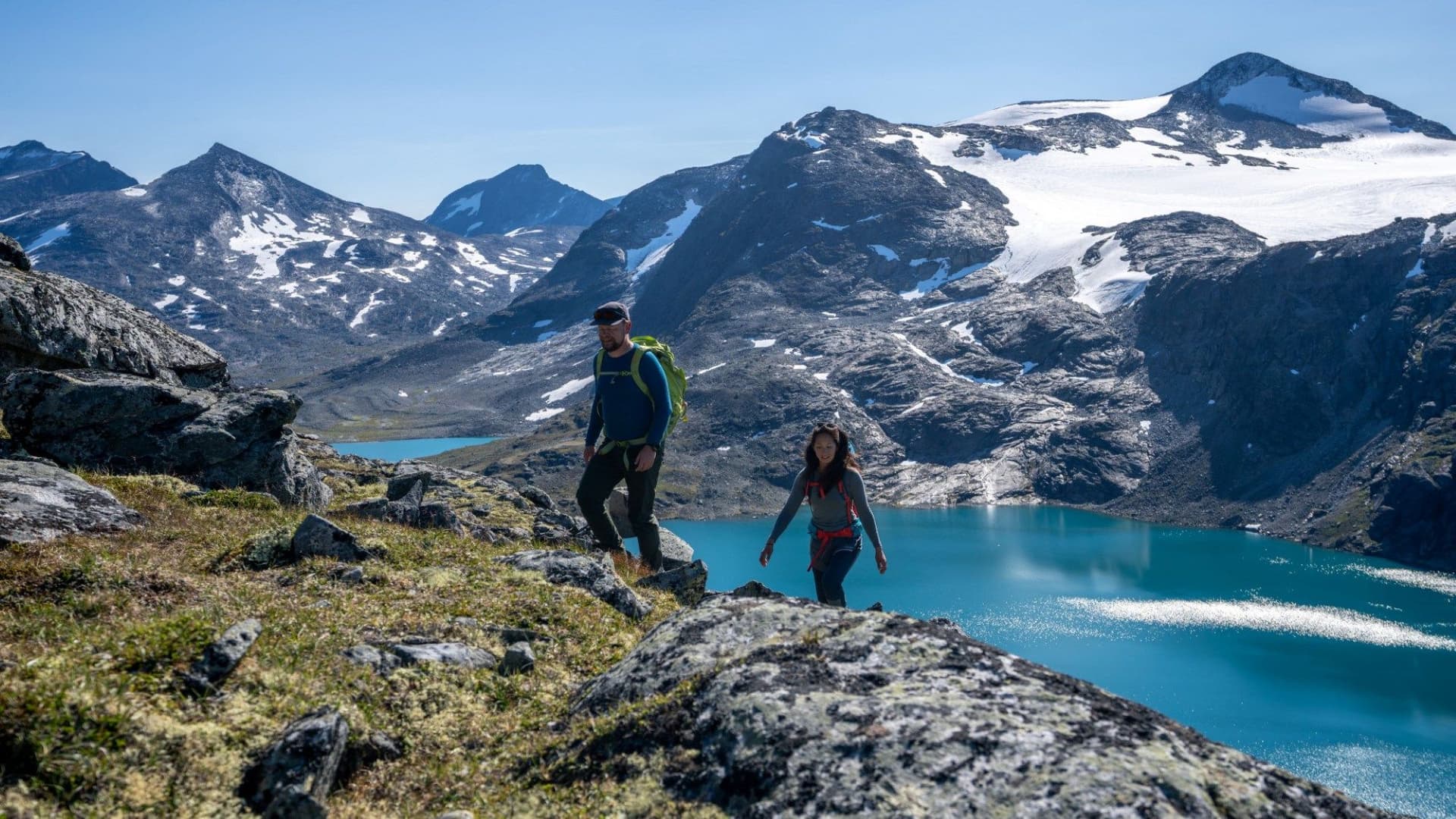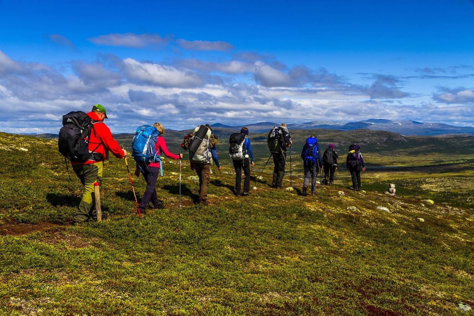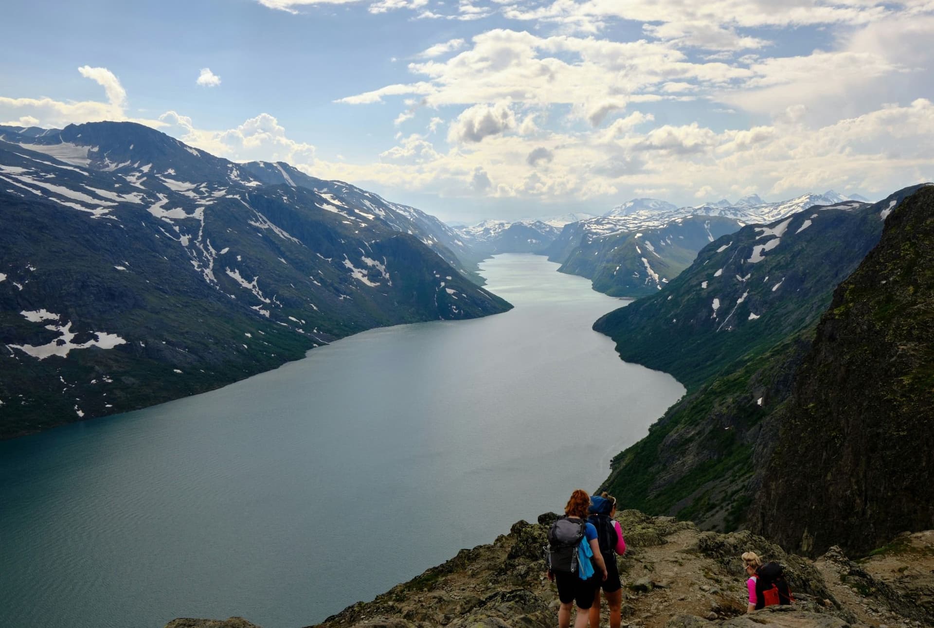
Hiking Norway is defined less by a single trail than by a choice between fjord country and high mountain country. Choose the deep fjords of the west and the days revolve around ferries, steep switchbacks straight up from the water, and views that drop hundreds of metres to blue-black water below. Choose the high plateaus and glaciers of the interior, places like Jotunheimen or Hardangervidda, and the days turn into ridgelines, scree, and summits above 2,000 m (6,562 ft). Few hiking destinations let a traveller build an entire trip around either landscape, or a deliberate mix of both, and that decision should come before anything else in a Norway hiking itinerary.
Norway stretches more than 1,750 km (1,087 mi) from the North Sea coast in the south to the Arctic tundra beyond the Arctic Circle, and hiking here changes character with every few hundred kilometres north. Southern Norway offers the classic combination of fjord and glacier within a single day trip. Central Norway, around Jotunheimen and Rondane, holds the country's highest peaks and its most established multi-day trekking culture. The far north, including the Lofoten and Vesterålen archipelagos, trades altitude for the Arctic Ocean itself, with trails that climb straight from sea level to sharp granite summits.
What holds the whole system together is the Norwegian Trekking Association, known locally as DNT (Den Norske Turistforening). Founded in 1868, DNT maintains more than 550 mountain cabins and roughly 22,000 km (13,670 mi) of marked summer trail, spaced closely enough that a hiker can move from cabin to cabin for a week or more without carrying a tent or cooking gear. This cabin-to-cabin tradition, more than any single peak or fjord, is what separates hiking in Norway from hiking almost anywhere else in Europe.
Infrastructure this good creates its own expectations, and they are worth setting honestly. Norwegian trail times run short, since locals hike fast, marked times assume a brisk and steady pace, and a first-time visitor should budget more time than the signpost suggests. Weather turns quickly above the treeline even in July, and several of the country's best-known routes, Trolltunga and Besseggen among them, cover serious distance and elevation gain in a single day with no shortcut back to the trailhead. In Norway, preparation counts for more than ambition.
The country's signature routes span from famous to nearly unknown. Trolltunga, a slab of rock jutting 700 m (2,297 ft) above Lake Ringedalsvatnet, and Preikestolen, the sheer 604 m (1,982 ft) cliff above Lysefjorden, draw the crowds and the postcards. Besseggen, the narrow ridge between two differently coloured lakes in Jotunheimen National Park, is the classic base for anyone chasing Norway's highest peaks. Further north, the Lofoten Islands offer short, steep climbs straight out of the sea to viewpoints with few equals anywhere in Europe.
This guide covers the geography that shapes the hiking, the human history behind the trails, the cabin culture and safety code that Norwegians build their mountain life around, and the practical detail (seasons, routes, food, and logistics) needed to plan a serious hiking trip, whether that means one week around Jotunheimen or a longer traverse from fjord to fjord.
Explore our amazing hiking tours in Norway now!
Norway's landscape is fundamentally a story of ice. During the last glaciation, kilometre-thick ice sheets ground deep valleys into the bedrock of the Scandinavian Peninsula, and when the ice retreated, seawater flooded in behind it to create the fjords. Sognefjord, the longest, reaches 205 km (127 mi) inland and drops to depths of more than 1,300 m (4,265 ft). Nærøyfjord, its narrow UNESCO-listed offshoot, closes to just 250 m (820 ft) wide between sheer rock walls. Hiking above these fjords means near-constant elevation change, since trails rarely stay level, climbing straight out of sea-level villages toward viewpoints hundreds of metres up.
Inland, the terrain changes again. The Scandinavian Mountains run the length of the country, culminating in Jotunheimen, whose name translates roughly to home of the giants, where Galdhøpiggen reaches 2,469 m (8,100 ft), the highest point in Northern Europe. East of Jotunheimen lies Hardangervidda, Europe's largest mountain plateau at roughly 8,000 sq km (3,089 sq mi), a windswept expanse of rock, lake, and tundra that holds Europe's largest wild reindeer herd. These high interior regions hold snow later into the year than the coast and demand different preparation from fjord walking, with more exposure, harder navigation, and genuine remoteness.
Norway's coastline, among the longest in the world once every fjord and island is counted, breaks apart entirely north of the Arctic Circle into the Lofoten and Vesterålen archipelagos. Granite peaks here rise directly from the sea to heights of 900 to 1,200 m (2,953 to 3,937 ft) in less than 3 km (1.9 mi) of walking, producing some of the steepest, most immediate hiking gradients in Europe. Wildlife reflects this range of habitat. White-tailed sea eagles patrol the coast, wild reindeer graze the high plateaus, moose move through the birch forests of the valleys, and arctic fox survive in the northern mountains, though sightings of the fox remain rare.
The country's north-south length means hikers should not expect one climate. Southern and western Norway sit under a maritime influence that brings heavy, frequent rain, especially around Bergen, one of Europe's wettest cities. The interior mountains hold a drier, more continental climate with sharper temperature swings between sun and shade. The far north operates on an entirely different calendar, governed by the midnight sun in summer and the polar night in winter rather than by temperature alone. Planning a trip means planning around geography first and dates second.
Long before Norway existed as a nation, the Sami people inhabited its northern regions as part of Sápmi, a homeland spanning today's Norway, Sweden, Finland, and Russia's Kola Peninsula. Historical records place organised reindeer herding among the Sami as far back as the ninth century, structured around siidat, family-based herding units that moved with the animals between winter and summer pasture. Coastal Sami communities built a different life around fishing and farming rather than migration. Norwegian settlement from the south pushed steadily into Sami territory from the seventeenth century onward, straining traditional grazing routes, and the tension between reindeer husbandry and land development, mining, wind power, and now hiking tourism, continues in parts of Finnmark and Trøndelag today. Norway's government has formally acknowledged decades of enforced assimilation policy toward the Sami, and a national Truth and Reconciliation Commission delivered its findings in 2023, a reminder that the history behind these landscapes remains an active conversation rather than a closed chapter.
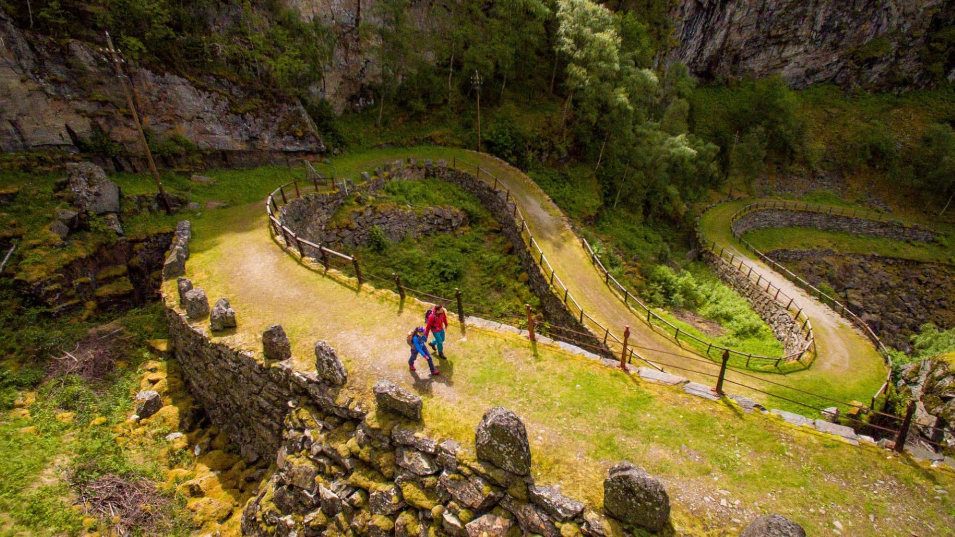
Further south, Norway's hiking corridors trace older human routes. Many valley trails follow paths first cut by farmers moving livestock to seter, the high summer pastures still used by some families today, and by traders crossing the mountains between fjord and inland market towns. Aurlandsdalen, one of the country's classic multi-day hikes, follows a valley route used for centuries before it became a trekking destination.
The nineteenth century reshaped how Norwegians related to their own mountains. National Romanticism, a cultural movement built on landscape painting, folklore collection, and a search for identity ahead of full independence from Sweden in 1905, turned the fjords and peaks into national symbols rather than simply terrain to cross. Out of this same period came friluftsliv, a term loosely translated as open-air life and first used in writing by Henrik Ibsen in 1859. Friluftsliv describes an approach to nature that is unhurried, non-competitive, and treats time outdoors as essential rather than recreational, and it remains the closest thing Norway has to a national outdoor philosophy.
The Norwegian Trekking Association was founded in 1868, initially by and for an urban middle class eager to access mountains their forebears had mostly worked around rather than walked through. It grew, slowly at first and then rapidly through the twentieth century, into the cabin network that now defines hiking in Norway. During the Second World War, that same network took on a different purpose, sheltering resistance fighters and refugees moving toward neutral Sweden across the mountains. Today DNT counts roughly 320,000 members in a country of 5.5 million people, a level of participation that reflects how deeply hiking sits inside ordinary Norwegian life rather than existing as a separate tourist activity.
Ask a Norwegian hiker about safety and the answer often comes as a list of nine short rules that most schoolchildren can recite, known as Fjellvettreglene, the Mountain Code. Written jointly by DNT and the Norwegian Red Cross after a string of fatal accidents at Easter 1950, and revised in 1967 and again in 2016, the code condenses decades of mountain rescue experience into plain, memorable instructions. Plan your trip and tell someone your route, check the weather and avalanche forecast, turn back in good time, and never treat retreat as a failure.
What makes Fjellvettreglene distinctive is not the content, which echoes mountain safety advice found almost anywhere, but its cultural weight. The code is printed on cabin walls, taught in schools, referenced in weather broadcasts, and quoted almost reflexively by locals discussing a route. It reflects a national self-reliance built into Norway's uniquely open access to wild country. With over 550 unstaffed and self-service cabins, an extensive marked trail network, and a right to roam that predates any formal law, Norway hands hikers enormous freedom, and Fjellvettreglene is the cultural counterweight, a shared expectation that hikers take responsibility for their own judgment rather than assuming infrastructure will save them.
For visitors, the code translates into practical habits worth adopting regardless of experience level. Check the forecast on the YR weather app before committing to an exposed ridge, carry an extra insulating layer even on a warm morning, and treat a published trail time as a guide rather than a guarantee. On popular routes like Trolltunga and Besseggen, where rescue crews respond to underprepared hikers every summer, following Fjellvettreglene is not excess caution. It is simply how hiking in Norway is meant to be done.
Norway's hiking season is short and concentrated, and the right window depends heavily on which landscape a hiker has chosen. The season is tightest in the high interior and most forgiving along the coast.
This is the core hiking season across almost all of Norway. Snow typically clears from lower trails by early June and from high mountain passes in Jotunheimen and Hardangervidda by late June or early July. Daytime temperatures in the mountains generally run 8°C to 18°C (46°F to 64°F), though wind and altitude can drop that quickly on an exposed ridge. Above the Arctic Circle, the midnight sun holds from late May to late July, meaning towns like Svolvær in Lofoten see no real darkness for weeks and hikers can extend a day's walk well past midnight if the weather cooperates. July is peak season everywhere, with crowded car parks at Trolltunga and Preikestolen, booked-out DNT staffed lodges, and higher prices; August offers similar weather with slightly thinner crowds and is often the better month for the most popular routes.
May suits lower valley and coastal walks well but arrives too early for the high mountains, where snow often persists above 1,300 to 1,500 m (4,265 to 4,921 ft) and river crossings run high with meltwater. September brings the first autumn colour to the birch forests and noticeably fewer hikers on the trail, along with a real chance of the northern lights returning to the far north as darker nights arrive. Weather turns less predictable in September, with the first proper storms of the season possible from mid-month onward.
Norway's mountain hiking season effectively closes from October through April. Snow, ice, and short daylight make most high trails unsafe without winter mountaineering skills and equipment, and many DNT staffed lodges close outside the summer and Easter ski periods. Lower coastal walks around Bergen or Lofoten remain possible year round for those prepared for rain, wind, and limited daylight, but this is not the season for hiking Norway's classic routes.
Dive into our curated Norway hiking adventures today!
Norway holds far more trails than any single guide can cover, so this list favours range over completeness, with two iconic day hikes, the country's classic mountain ridge, a valley crossing with real depth, an Arctic island climb, and a multi-day plateau traverse for hikers ready for something wilder.
No image in Norway hiking is more photographed than Trolltunga, a slab of rock that juts horizontally out of the mountainside roughly 700 m (2,297 ft) above Lake Ringedalsvatnet in the Hardangerfjord region. From the main Skjeggedal car park, the round trip covers 27 km (16.8 mi) and roughly 1,100 m (3,609 ft) of elevation gain, taking most hikers 10 to 12 hours; a newer toll road to Mågelitopp shortens this to about 20 km (12.4 mi), though parking there is limited. This is not a technical hike, but it is a long one, and conditions above 1,000 m (3,281 ft) can shift from clear to fogbound within the hour, so start early and treat the route's two emergency bivouac shelters as emergencies only.
Quick Facts: Trolltunga Total Distance: 27 km (16.8 mi) round trip from Skjeggedal, 20 km (12.4 mi) from Mågelitopp Duration: 10 to 12 hours Difficulty: Very Challenging High Point: Trolltunga ledge, 1,126 m (3,694 ft) Best Season: June to September Gateway Town: Odda
Preikestolen, or Pulpit Rock, is Trolltunga's shorter and more accessible cousin, and the better choice for a hiker who wants a genuine Norwegian mountain view without a full-day commitment. The trail climbs 3.8 km (2.4 mi) each way from the Preikestolen Fjellstue car park to a flat granite platform 604 m (1,982 ft) above Lysefjorden, gaining a moderate 334 m (1,096 ft) across well-maintained switchbacks, and most hikers finish the round trip in 4 to 5 hours. The path can be crowded and, in wet or icy conditions, genuinely slick near the top, so proper footwear matters even on a short walk. It pairs naturally with Kjerag, a taller cliff hike further south along the same fjord, for hikers with a second day to spare.
Quick Facts: Preikestolen Total Distance: 7.6 km (4.7 mi) round trip Duration: 4 to 5 hours Difficulty: Moderate High Point: Preikestolen, 604 m (1,982 ft) Best Season: April to October Combined Well With: Kjerag, a full day's drive and hike further south
Besseggen Ridge is the trail most hikers picture when they imagine Jotunheimen National Park, a narrow ridge with the glacial green of Lake Gjende on one side and the deep blue of Lake Bessvatnet, 400 m (1,312 ft) higher, on the other. Most hikers take the scheduled boat from Gjendesheim to Memurubu, then walk the 14 km (8.7 mi) back over the ridge, climbing to the high point at Veslfjellet, 1,743 m (5,719 ft), in 6 to 8 hours including breaks. The ridge itself involves scrambling over exposed rock, and while no climbing equipment is required, hikers uncomfortable with heights should treat it seriously; more than 50,000 people complete the route each season, so July and August traffic is heavy. It also works well as the opening or closing day of a longer Jotunheimen circuit toward Galdhøpiggen, Norway's highest peak.
Quick Facts: Besseggen Ridge Total Distance: 14 km (8.7 mi) Duration: 6 to 8 hours Difficulty: Challenging High Point: Veslfjellet, 1,743 m (5,719 ft) Best Season: Late June to mid-September Accommodation: DNT lodges at Gjendesheim and Memurubu Safety Note: Book the Gjende ferry in advance during peak season
Nicknamed the Grand Canyon of Norway, Aurlandsdalen is a long glacial valley south of Flåm and one of the country's classic multi-day valley hikes, though a shorter lower section makes it accessible to strong day hikers too. The full route, from Østerbø down to Vassbygdi, covers around 34 km (21.1 mi), typically split across two days with an overnight at a DNT cabin partway down. The lower section alone, roughly 19 km (11.8 mi), can be walked in a demanding single day of six hours or more, dropping past waterfalls, sheer canyon walls, and the stone remains of farms abandoned as mountain life grew unsustainable through the twentieth century. Snow can linger on the upper valley into June, so early-season hikers should confirm conditions, and the route combines naturally with the nearby Flåm Railway and Nærøyfjord.
Quick Facts: Aurlandsdalen Total Distance: 34 km (21.1 mi) full route, or 19 km (11.8 mi) lower section only Duration: 2 days full route, 6 hours lower section Difficulty: Moderate to Challenging Highlights: Waterfalls, abandoned farms, canyon walls Accommodation: DNT self-service cabin at Østerbø Best Season: Mid-June to September
Hiking in the Lofoten Islands feels different from anywhere else in this guide, largely because the mountains rise straight out of the Norwegian Sea with almost no foothills to soften the climb. Reinebringen, above the fishing village of Reine, is the archipelago's signature short hike, a steep, recently rebuilt stone staircase that climbs 448 m (1,470 ft) in just over 1.0 km (0.6 mi), reaching a viewpoint over Reine's red rorbu cabins in under an hour for a fit hiker. For a longer outing, Ryten, above the beach at Kvalvika, covers an 8.0 km (5.0 mi) round trip and 543 m (1,781 ft) of gain, finishing on a summit shelf above one of Norway's most photographed beaches. Both trails get busy in July, and Reinebringen's staircase can bottleneck at peak times, so an early start pays off; Lofoten's maritime climate also keeps its hiking season slightly longer than the interior mountains.
Quick Facts: Lofoten Total Distance: Reinebringen 2.5 km (1.6 mi); Ryten 8.0 km (5.0 mi) Duration: Reinebringen 1.5 to 2 hours; Ryten 3 to 4 hours Difficulty: Moderate High Point: Reinebringen 448 m (1,470 ft); Ryten 543 m (1,781 ft) Best Season: June to September Gateway Town: Reine
For hikers who want the cabin-to-cabin tradition at its most complete, Hardangervidda offers a multi-day crossing of Europe's largest mountain plateau, a windswept expanse of rock, lake, and open tundra that holds the continent's largest herd of wild reindeer. A typical route runs 60 to 80 km (37.3 to 49.7 mi) over 4 to 5 days, moving between DNT staffed and self-service cabins spaced roughly a day's walk apart. There is no single dramatic viewpoint here in the way Trolltunga or Preikestolen offer one; the appeal is scale, solitude, and open country with the horizon rarely broken by a tree, and fast-changing weather on the exposed plateau means this route suits experienced hikers rather than a first trip to Norway.
Quick Facts: Hardangervidda Total Distance: 60 to 80 km (37.3 to 49.7 mi), sample multi-day route Duration: 4 to 5 days Difficulty: Challenging Highlights: Wild reindeer, open tundra, remote lakes Accommodation: DNT staffed and self-service cabins along the route Best Season: Mid-July to early September
Get started with your Hiking adventure now!
Norwegian food culture on the trail runs on two different systems, what is eaten in towns and staffed lodges, and what gets carried or found in self-service cabins. Both reflect a country shaped by cold-water fishing and short growing seasons rather than agricultural abundance.
Coastal Norway's food identity centres on the sea. Fresh cod, known locally as skrei during its winter migration, salmon, and fjord shrimp appear on menus from Bergen to Tromsø, often served simply, poached, smoked, or cold on open rye sandwiches called smørbrød. Inland and in the mountains, lamb takes over, most famously in fårikål, a slow-cooked stew of mutton, cabbage, and whole black peppercorns considered Norway's national dish and traditionally eaten as autumn arrives.
Brunost, Norway's caramelised brown cheese made by reducing whey until its natural sugars brown, is the closest thing the country has to a shared culinary ritual, thin slices on crispbread or waffles, eaten daily in most Norwegian households and offered at nearly every DNT cabin breakfast table. Rakfisk, salted and fermented trout aged for one to three months, is the more adventurous regional specialty, particularly associated with Valdres, where an annual rakfisk festival celebrates the dish each autumn; it is usually served with flatbread, sour cream, and raw onion for hikers willing to try it. The DNT self-service cabin system shapes trail food more than any restaurant. These unstaffed huts come stocked with tinned fish and meat, dried soup, coffee, and rye crackers, priced on an honour system and settled by app or payment form at the end of a stay. Staffed lodges go further, serving a full three-course dinner most nights, often built around trout, reindeer, or lamb depending on the region, alongside a generous self-service breakfast.
Resupply outside the cabin system means small grocery stores in gateway towns like Odda, Lom, or Reine, which stock enough for a few days but rarely specialist trekking food. Cloudberries, known locally as multer, ripen in high bogs through August and are traditionally served with cream as a dessert, a small seasonal ritual worth watching for on a late-summer hike.
Norway's accommodation system for hikers is built almost entirely around DNT, the Norwegian Trekking Association, whose network of more than 550 cabins makes multi-day hiking possible without carrying a tent or a stove.
Staffed lodges sit at the top of the system. These are full-service cabins, typically open from late June to mid-September, that provide a hot dinner, a packed-lunch option, and a proper bed in a shared room. Prices run around 1,100 NOK (roughly $105) for DNT members with full board, and about double for non-members. During peak season, popular lodges like Gjendesheim and Memurubu in Jotunheimen can book out, so reserving ahead in July and August is worth the effort.
Self-service cabins form the backbone of the network. These are unstaffed huts stocked with firewood, cooking gear, and food provisions, priced from roughly 200 to 315 NOK (about $19 to $30) per night. Hikers cook for themselves, settle payment through the DNT app or a form left in a payment box, and generally need the universal DNT key to get in, which requires membership. No-service cabins offer only basic shelter, walls, a roof, and sometimes a wood stove, with hikers responsible for bringing everything else, including sleeping gear.
DNT membership costs roughly 800 NOK (about $75) per year and includes the universal cabin key (a refundable 100 NOK deposit), member pricing at every cabin, and priority for beds during busy periods. For any trip involving more than one or two hut nights, membership typically pays for itself. All cabins require a sleeping bag liner or sheet set, even where blankets and pillows are provided, since bedding is not laundered between every guest.
Wild camping is legal across most of Norway's uncultivated land under the country's long-standing right to roam, provided a tent is pitched at least 150 m (492 ft) from the nearest occupied building and moved after two nights in the same spot. Combined with the cabin network, this gives hikers genuine flexibility, cabin to cabin for comfort, or a mix of huts and open-country camping for a more independent trip.
Most hiking trips in Norway begin at one of four airports, Oslo Gardermoen for Jotunheimen, Rondane, and the eastern mountains; Bergen Flesland for Trolltunga, Preikestolen, and the western fjords; Trondheim Værnes for Trollheimen and central Norway; and Tromsø or Bodø for Lofoten and the Arctic north, sometimes reached more efficiently by internal flight than by road. The Bergensbanen railway between Oslo and Bergen, and the connecting Flåm Railway down into the Aurlandsfjord, are hiking-adjacent journeys in their own right, crossing the Hardangervidda plateau at over 1,200 m (3,937 ft). For fjord and island regions, expect a final leg by local ferry or bus to reach the actual trailhead.
UT.no, run by DNT, is the standard route-planning resource, with maps, cabin bookings, and trail descriptions for the entire country, though it is Norwegian-only and best used with a translation tool. Norgeskart, the national mapping service, and the DNT app both work offline once downloaded, which matters given patchy mobile coverage in the high mountains. Summer trails are marked with a red painted T on rocks and cairns, a system consistent enough that hikers moving between regions do not need to relearn local markers.
Norway uses the Norwegian krone (NOK), and the country is close to fully cashless, with cards and mobile payment working almost everywhere, including at some self-service cabin payment boxes. Prices run high by European standards, particularly for restaurant meals and alcohol, so hikers on a budget benefit from the cabin system's fixed, moderate pricing. Resupply towns near major trailheads, Odda, Lom, Åndalsnes, and Reine among them, carry basic groceries but limited specialist trekking food, so bring dietary essentials from a larger city first.
Mountain rescue in Norway is coordinated through the emergency number 112, with the Red Cross and volunteer teams playing a significant role in the response. The greatest real risks for visitors are underestimating trail length, being caught above the treeline in sudden weather, and river crossings swollen by snowmelt in June. Checking the YR weather forecast before any exposed route, and following the Fjellvettreglene mountain code outlined earlier in this guide, addresses most of what goes wrong on Norway's trails.
It depends on the route. Preikestolen and Reinebringen suit most reasonably active hikers with a few hours of stamina. Trolltunga, Besseggen, and multi-day routes across Hardangervidda demand genuine fitness, comfort with 6 to 12 hour days, and sustained elevation gain, so start with a shorter route and build up if in doubt, since Norwegian trail times assume a brisk local pace.
No permit is required for hiking Norway's marked trails or for wild camping under the right to roam, known as allemannsretten, which covers uncultivated land throughout the country. The only formal requirement that affects most hikers is DNT membership, needed for the key to self-service and no-service cabins, though staffed lodges and marked trails stay open to everyone regardless.
Norway's trail marking and cabin system make independent hiking realistic for most experienced hikers, and DNT runs organised group tours for those who want structure without a private guide. A local guide adds real value on technical or exposed routes, for first-time visitors unsure of navigation, or on remote multi-day traverses like Hardangervidda, where the margin for error is smaller.
For a single hut night, probably not; non-members can still stay at staffed lodges and many self-service cabins at a higher rate. For any trip of three or more cabin nights, or any need to access locked self-service or no-service huts, membership at roughly 800 NOK (about $75) a year pays for itself quickly.
Layered clothing is essential even in July, since temperatures at altitude can swing 10°C (18°F) in a single afternoon. A waterproof shell, warm mid-layer, sturdy broken-in boots, and a headlamp for cabin use are standard, and hikers using self-service cabins should also bring a sleeping bag liner or sheet set, since bedding is provided but not laundered between guests.
Yes. Allemannsretten permits camping on uncultivated land, provided a tent sits at least 150 m (492 ft) from the nearest occupied building and moves after two consecutive nights. Fires are restricted in forested areas between mid-April and mid-September, and some national parks' most sensitive zones carry additional local restrictions worth checking in advance.
Moose, reindeer, and occasionally arctic fox are the animals most hikers see, and none pose a serious threat if given space, though a startled moose with a calf nearby deserves a wide berth. Wolves and bears exist in small, isolated populations, but not near the main hiking routes covered in this guide.
Trolltunga has no formal booking requirement, but parking at the upper Mågelitopp lot fills early in peak season, so an early start matters more than a reservation. Besseggen requires booking the Gjende ferry in advance during July and August, since sailings sell out and there is no way to complete the classic route without it.
North of the Arctic Circle, including Lofoten and Vesterålen, the sun does not fully set from roughly late May to late July, extending the practical hiking day into what would elsewhere be night. Southern and central Norway do not see true midnight sun but still get long summer daylight, often 18 to 20 hours in June, giving more flexibility for a late start or an extended day on the trail.
Get started with your Hiking adventure now!
Norway suits the hiker who wants structure without losing wildness, a trail network detailed enough to plan a precise itinerary, and a cabin system reliable enough to travel light, wrapped around landscapes that still feel genuinely remote once the trailhead disappears behind you. Whether the goal is a single dramatic day at Trolltunga or a week moving cabin to cabin across Hardangervidda, this is a country built for hikers willing to prepare properly.
What makes it distinctive, more than any single peak, is the culture DNT built around it, a shared trail system open to everyone, a safety code every Norwegian grows up knowing, and cabins that run on trust as much as on locks and keys. That freedom is rare, and it is worth experiencing on its own terms.
Explore our guided hiking journeys at Art of Active Travel.
Dive into our curated Norway hiking adventures today!
Create a private trip or join a small-group departure.