 Chat with us on WhatsApp. We're just a message away.
Hiking Guides | Last updated:
By Shivangi Vaswani •
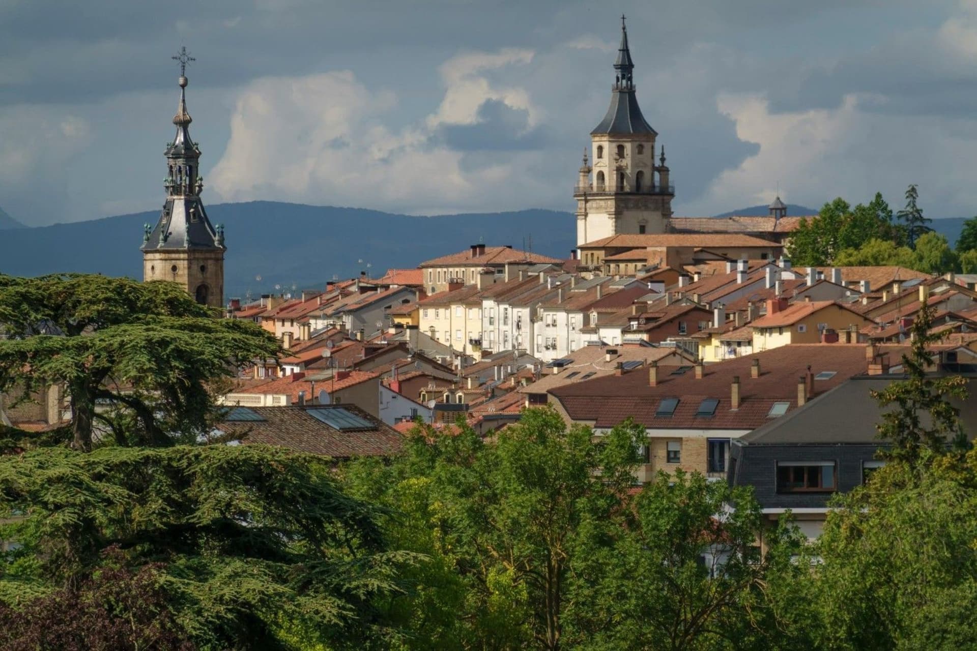
Hiking in La Rioja Wine Region means walking through two landscapes that rarely share a single trail. A cultivated valley of vines running to the horizon, and a wall of limestone and beech-clad mountains rising behind it. The Ebro River splits the plain in two, and on both banks, more than six hundred wineries work land that has produced wine since long before the Romans arrived. Hiking La Rioja Wine Region is for walkers who want scenery with a story attached, not just a view.
The region is small by Spanish standards, just over 5,045 sq km (1,948 sq mi), yet it packs an unusual range of terrain into that footprint. Rioja Alta and Rioja Alavesa hold the classic vineyard postcard: rows of Tempranillo climbing gentle slopes around stone villages. Rioja Oriental, drier and warmer, opens onto wide grain country and volcanic-looking outcrops. Behind all three, the Sierra de la Demanda and Sierra Cebollera climb past 2,000 m (6,562 ft), culminating at San Lorenzo, the region's highest point at 2,271 m (7,452 ft).
Trail infrastructure here does not resemble the hut-to-hut networks of the Alps or Scandinavia. Hikers instead link a patchwork of local footpaths, long-distance GR trails such as the GR-93 and GR-38, disused railway lines converted into vías verdes, and vineyard tracks that wineries are increasingly happy to have you walk. Expect honest, moderate trail conditions: some routes carry careful waymarking, others need a downloaded GPX track and a willingness to ask a farmer for directions.
Two features anchor most trip planning here. The first is the Camino de Santiago, which crosses the region from west to east through Nájera and Santo Domingo de la Calzada. The second is the Hoces del Leza, one of several limestone canyons carved into the southern hills by rivers dropping out of the Cameros mountains. Between them sits a large amount of quieter walking: forest circuits above Ezcaray, ridge routes above the Sonsierra, and vineyard paths that connect one bodega to the next without leaving farm tracks.
This guide covers the geography, history, seasons, and trail options that matter for planning a trip, along with the food, lodging, and logistics that turn a walk into a full week in the region. It is written for hikers who already know their way around a topographic map and want the practical detail to start planning without a second research session.
Explore our amazing hiking tours in La Rioja Wine Region now!
La Rioja sits in the upper Ebro valley, a long trench running roughly east to west between two mountain systems. The Sierra de Cantabria and the Sierra de Toloño close the valley to the north, on the Basque side of the Ebro, while the Sierra de la Demanda and Sierra Cebollera rise to the south as outriders of the Iberian mountain system. Most of the vineyard plain sits at around 460 m (1,509 ft), rimmed by peaks that climb past 2,000 m (6,562 ft) within sight of the vines.
The wine region divides into three official subzones, and each has a distinct feel underfoot. Rioja Alta, in the west, has clay-limestone soils, a cooler continental climate softened by Atlantic influence, and vineyards planted as high as 700 m (2,297 ft). Rioja Alavesa, across the river in the Basque province of Álava, shares similar limestone ground on steeper slopes. Rioja Oriental, formerly known as Rioja Baja, spreads east toward Aragón and Navarre under a drier, more Mediterranean sky, with Garnacha replacing much of the Tempranillo.
South of the vines, the land folds into a set of river valleys, the Tirón, Oja, Najerilla, Iregua, Leza, Jubera, Cidacos, and Alhama, all draining north into the Ebro from the Cameros hills and the Sierra de la Demanda. Several of these rivers have carved sheer limestone gorges, known locally as hoces, where the walking turns from vineyard track to canyon path within an hour. The Sierra Cebollera Natural Park, the region's only officially protected natural area, covers 23,640 hectares (91.3 sq mi) of beech, oak, and pine forest around waterfalls such as the Puente Ra.
The Sierra de la Demanda itself belongs to the Iberian mountain system and extends south into the province of Burgos, close to the Atapuerca archaeological sites. Its rounded, high pastures and beech forests shelter roe deer and wild boar, while the limestone walls of the Leza and Jubera canyons, protected within a UNESCO Biosphere Reserve, host colonies of griffon vultures and choughs that hikers can watch riding the thermals above the gorge.
Long before the vineyards, the Ebro valley belonged to the Berones, a Celtiberian people who farmed and fortified these river terraces. Phoenician traders reached the area by the eleventh century BC, leaving traces near what is now Alfaro, and Roman colonists later founded Calagurris, today's Calahorra, birthplace of the rhetorician Quintilian. The Romans planted vines methodically along the Ebro and built cellars to supply their garrisons, laying down the first commercial foundation of what would become Rioja wine.
During the early medieval centuries, the Sierra de la Demanda marked a shifting frontier between Christian and Muslim-held territory as the Reconquista pushed south. Once the frontier moved on, the region's fortunes turned toward pilgrimage. The French route of the Camino de Santiago crosses La Rioja west to east, passing through Nájera, once capital of the medieval Kingdom of Navarre, and Santo Domingo de la Calzada, a town built almost entirely around its cathedral and the saint who paved roads for pilgrims.
Near Nájera, the monasteries of Suso and Yuso at San Millán de la Cogolla hold a claim that outlasts any vintage: scholars consider the marginal notes written there by monks, the Glosas Emilianenses, the earliest surviving text in written Castilian Spanish. The thirteenth-century monk Gonzalo de Berceo, who lived at Suso, is credited as the first named poet to write in the vernacular rather than Latin. Both monasteries are UNESCO World Heritage Sites, and the trails around them pass through the same wooded valley that sheltered their scriptoria.
Wine and monastery life stayed closely linked through the Middle Ages, with religious houses preserving viticultural knowledge during periods when little else in the region was written down. The modern wine industry took shape later: the winemaker Manuel Quintano brought Bordeaux-style oak aging to Rioja in the late eighteenth century, and when phylloxera devastated French vineyards a century later, Bordeaux merchants and techniques moved south in large numbers, modernizing Rioja's production. The region became Spain's first Denominación de Origen in 1925 and its first Denominación de Origen Calificada in 1991.
Not all of the region's traditions revolve around wine. In the Cameros mountain town of Anguiano, dancers known as the Danzadores climb onto tall wooden stilts each July and spin down a steep, cobbled street during the festival of Santa Magdalena, a tradition found nowhere else in Spain. Hikers walking the Valvanera trail pass directly through Anguiano and can time a visit to coincide with the festival, one of the few moments where the region's mountain culture, rather than its vineyards, takes center stage.
Most hiking destinations keep trails and working land at arm's length. La Rioja does not. Public footpaths here run directly across active vineyards, and a single day's walk often starts on a forest track and ends on a farm lane threading between rows of Tempranillo. This overlap between hiking and viticulture shapes nearly every route decision in the region, from what time you set out to which shoes you pack, and it is worth understanding before you plan a single day here.
One of the most distinctive sights on these paths is the guardaviñas, a small dry-stone hut that grape growers once used for shelter and tool storage between the rows. Hundreds still stand across Rioja Alta and the Sonsierra, and many hiking routes are built specifically to pass a cluster of them. During the grape harvest, or vendimia, which usually runs from September into October depending on the variety and subzone, these same tracks fill with tractors moving fruit to the bodegas, and hikers are expected to give way without complaint.
The three regional wine route associations, covering Rioja Alta, Rioja Alavesa, and Rioja Oriental, maintain self-guided vineyard paths that connect wine villages and individual bodegas, and their maps are a useful starting point for planning a day that mixes walking and tasting. The etiquette is simple and consistently enforced by locals: stay on marked tracks rather than cutting across rows, do not sit on the dry-stone field walls that support the vines, and book winery visits ahead rather than turning up unannounced, particularly during harvest weekends.
Because tastings are woven so naturally into a day's walk, the sensible order is to hike first and taste after, not the other way around. Save the wine for the end of the route, arrange a taxi or a designated driver if you plan to visit more than one bodega, and treat the vineyard the way you would treat any other working landscape you happen to be walking through, with attention and a light footprint.
Spring brings wildflowers to the vine rows and wild orchids to the canyon slopes, with daytime temperatures typically running 10 to 22°C (50 to 72°F). This is a comfortable season for every trail type covered in this guide, from vineyard paths to the Leza canyon, though snow can still linger above 1,800 m (5,906 ft) in the Sierra de la Demanda into May.
The Ebro valley runs hot in summer, with lower vineyard country regularly reaching 30 to 38°C (86 to 100°F) by early afternoon. Vineyard walks are best done at dawn or in the evening during these months. The higher trails of the Sierra de la Demanda and Sierra Cebollera stay noticeably cooler and are the better summer choice, though carrying at least two liters of water per person remains essential on any route with limited shade.
Autumn is the season most hikers should build a trip around. The grape harvest is underway, temperatures settle into a mild 12 to 24°C (54 to 75°F), and the vine leaves turn ochre, red, and pale yellow across the valley. Trails are busier than in spring but rarely crowded, and this is the one window where booking a winery visit several weeks ahead genuinely matters.
Winter is not recommended for the region's higher summit routes. San Lorenzo and the rest of the Sierra de la Demanda require winter mountaineering skills and proper snow equipment once conditions turn, and shaded sections of the limestone canyons ice over and become genuinely treacherous underfoot. Lower elevation vineyard walking remains fully open through winter, though, and rewards hikers with clear air, quiet paths, and empty tasting rooms.
Dive into our curated La Rioja Wine Region hiking adventures today!
The six routes below cover the range of terrain that defines hiking La Rioja Wine Region, from easy vineyard strolls to a genuine mountain summit. They are ordered from the most iconic vineyard walk through to the region's highest peak, so pick according to the day you want rather than working through the list in order.
This is the classic introduction to hiking La Rioja Wine Region, tracing farm tracks that fold around bends of the Ebro between three of the region's best-known wine towns. The path threads clay-limestone slopes planted with Tempranillo and Graciano, passing dozens of guardaviñas huts and the twelfth-century Romanesque hermitage of Santa María de la Piscina along the way.
Haro's old station district, built around the railway that once carried Rioja wine to the coast, makes a fitting start or finish point, and Briones adds a fortified hilltop silhouette to the skyline for most of the walk. The route works equally well as an out-and-back from any of the three towns or as a one-way walk with a taxi back, and it pairs naturally with a tasting booked for the end of the day rather than the middle.
Quick Facts: Rioja Alta Vineyard Path Total Distance: 8 to 12 km (5 to 7.5 mi) Duration: 2.5 to 4 hours Difficulty: Easy to Moderate Gateway Town: Haro Best Season: April to June, late September to October Highlights: Guardaviñas huts, Ebro river bends, Briones hilltop, Santa María de la Piscina hermitage
Starting from San Vicente de la Sonsierra or the nearby village of Ábalos, this loop climbs onto the ridge north of the Ebro for the widest panoramic views in Rioja Alta. The route links a ruined castle, a medieval bridge, and a scatter of isolated Romanesque hermitages, with long sightlines back over the vineyard mosaic toward Haro and Briones and, on clear days, to the Sierra de la Demanda beyond.
The terrain is mostly farm track and footpath with rolling elevation change rather than sustained climbing, which makes this a good option for hikers who want a full day out without technical difficulty. Harvest weeks add tractor traffic to the shared sections near the vineyards, so early starts are worth it for both the light and the quiet.
Quick Facts: Sonsierra Ridge and Ebro Viewpoints Total Distance: 12 to 16 km (7.5 to 9.9 mi) Duration: 4 to 5.5 hours Difficulty: Moderate Gateway Town: San Vicente de la Sonsierra or Ábalos Highlights: Castle ruins, medieval bridge, hermitages, vineyard and Ebro panoramas
The Leza canyon is where hiking La Rioja Wine Region stops feeling like a vineyard walk altogether. Between the villages of Leza de Río Leza and Soto en Cameros, the river has cut a limestone trench that the footpath follows along narrow shelf sections above the water, with griffon vultures and choughs tracing slow circles along the cliff walls.
This is the one route in this guide that demands real care with exposure. Sections narrow enough to require sure footing appear where the path hugs the canyon wall, and the trail is not suitable for anyone with severe vertigo. The canyon sits inside the Biosphere Reserve of the Leza, Jubera, Cidacos, and Alhama valleys, and access can close temporarily during the raptor nesting season in spring, so it is worth checking current notices before setting out.
Quick Facts: Hoces del Río Leza Total Distance: 10 to 12 km one way (6.2 to 7.5 mi) Duration: 3 to 4.5 hours Difficulty: Moderate, with exposure Gateway Town: Leza de Río Leza or Soto en Cameros Safety Note: Not suitable for severe vertigo; keep distance from cliff edges in wind or wet weather
The Monastery of Valvanera sits in a green, forested cirque above Anguiano, ringed by oak and beech and reached by a steady climb through the Sierra de la Demanda foothills. The monastery houses the venerated image of the Virgin of Valvanera, patron saint of La Rioja, and its Romanesque core makes a natural midpoint for a day that is as much about quiet forest as it is about history.
Anguiano itself, at the trailhead, is worth building extra time around. The town is known for its caparrones beans and, every July, for the Danzadores who spin down its steepest street on stilts during the Santa Magdalena festival. Hikers based in Rioja Alta can pair this route with an overnight in Ezcaray to explore more of the Demanda foothills the following day.
Quick Facts: Monastery of Valvanera Trail Total Distance: 8 to 10 km (5 to 6.2 mi) Duration: 2.5 to 3.5 hours Difficulty: Moderate Gateway Town: Anguiano Combined Well With: Anguiano village and the Danzadores stilt festival in July
San Lorenzo is La Rioja's highest point and the one genuine mountain summit within easy reach of the vineyards below. The standard route begins at the Valdezcaray ski station, climbs past the Ormazal and Nestaza passes, and reaches the summit altar dedicated to the Virgin of Valvanera, where views extend across the Ebro basin and, on a clear day, toward the Pyrenees.
The trail itself carries no technical difficulty in summer conditions, and the climb is more a question of stamina than skill. Weather is the real variable. Conditions above treeline can shift quickly, wind picks up hard on exposed sections near the summit, and hikers should carry a map even though the path is generally well defined in clear visibility.
Quick Facts: Ascent of San Lorenzo Total Distance: 7.8 to 9.3 km loop (4.8 to 5.8 mi) Duration: 3 to 5.5 hours Difficulty: Challenging High Point: San Lorenzo, 2,271 m (7,452 ft) Best Season: Late May to October, snow-free conditions Safety Note: Storms build quickly above treeline; carry a map even in clear weather
For hikers traveling with family, limited mobility, or simply less time, short graded paths connect wineries and viewpoints around several Rioja Alta towns. These routes stay mostly flat, follow riverside promenades and winery quarters, and need no special preparation beyond comfortable shoes and sun protection.
This is also the easiest way to combine hiking La Rioja Wine Region with a full wine tourism day, since the walking segments link directly to cellar doors, tasting rooms, and benches with river views. Confirm accessibility details directly with individual wineries if traveling with a wheelchair or stroller, since arrangements vary.
Quick Facts: Accessible Vineyard Walks Total Distance: 2 to 5 km (1.2 to 3.1 mi) Duration: 45 to 90 minutes Difficulty: Easy Gateway Towns: Haro, Briones, Cenicero, San Asensio Highlights: Riverside promenades, winery quarters, accessible surfaces
Get started with your Hiking adventure now!
A day of hiking La Rioja Wine Region builds an appetite for a cuisine that is direct and unpretentious rather than showy: potatoes, peppers, lamb, and the smoke of burning vine cuttings turn up in dish after dish across the region.
The signature dish is patatas a la riojana, a thick stew of potatoes, chorizo, and dried choricero peppers, sometimes called rancho or calderete depending on the village. The recipe traces back to nineteenth-century farm laborers around Alfaro, who combined the newly arrived potato crop with cured chorizo kept in clay jars. Chuletillas al sarmiento, lamb chops grilled directly over burning vine prunings, are the dish that most literally connects the vineyard to the plate, and they turn up at almost every bodega gathering and harvest celebration.
In the mountain town of Anguiano, small red caparrones beans headline their own annual festival, while Rioja Oriental's fertile huerta around Calahorra supplies the vegetables for menestra, a mixed vegetable dish built from artichokes, asparagus, and peas, each cooked separately and served as one plate. Bacalao a la riojana, salt cod simmered in a tomato and pepper sauce, and fardelejos, an almond pastry from Arnedo with roots in Moorish cooking, round out a food culture built almost entirely on local, unshowy ingredients.
The ritual worth adopting before a hike is the almuerzo, a hearty mid-morning second breakfast of fried eggs, chorizo, or wild mushrooms that field workers have long eaten before physical labor. It works just as well before a trail day. For lunch on longer routes, a bocata sandwich from a village bakery travels well, and it is worth remembering that many small shops close on Sunday afternoons, so stocking up a day ahead makes sense for weekend hikes.
Evenings belong in Logroño, where the pincho culture along Calle Laurel turns eating into a short, sociable crawl between bars rather than a sit-down meal, and where a glass of Rioja crianza or reserva is never far from a plate of grilled mushrooms or chorizo.
Unlike destinations with a formal mountain hut network, hiking La Rioja Wine Region works on a base-and-day-hike model. Hikers stay in a town and walk out and back, or arrange a taxi transfer for one-way routes, rather than moving hut to hut across the landscape.
Casas rurales, restored stone farmhouses converted into guesthouses, are the most common option and appear in nearly every wine village and Cameros mountain town, typically running 60 to 75 EUR per night. Albergues offer a cheaper alternative, from general hostels such as the sixty-bed Molino Viejo in Ezcaray to pilgrim-specific albergues along the Camino Francés in Santo Domingo de la Calzada, Nájera, and Grañón, where rates often run 10 to 20 EUR per night.
For a distinctive option, several wineries operate their own hotels, ranging from modest bodega guesthouses in villages like Albelda de Iregua to architectural landmarks such as the Frank Gehry-designed Hotel Marqués de Riscal in Elciego. Staying at a hotel-bodega puts a hiker inside the working landscape covered in the previous section, often with vineyard views from the room itself. Wild camping is not generally practiced or straightforwardly legal in La Rioja without landowner permission, and most hikers will not need it given how close most towns sit to their trailheads.
Booking ahead matters most during the September and October harvest and through August, when both casas rurales and hotel-bodegas fill quickly, particularly in smaller Cameros villages with only a handful of rooms.
Bilbao Airport is the most useful international gateway, roughly ninety minutes by road from Haro. Vitoria Airport (VIT) sits closer still to Rioja Alavesa, around fifty minutes away, and Pamplona Airport (PNA) offers a further alternative from the east. Logroño's own Agoncillo Airport (RJL) handles limited regional and seasonal routes. Renfe trains connect Madrid directly to Logroño, with a regional line continuing on to Haro, and regional buses link Logroño with Haro, Nájera, Ezcaray, Anguiano, and the Cameros villages.
Wikiloc and Komoot are both widely used for downloading GPX tracks in the region, and the Instituto Geográfico Nacional publishes 1:25,000 topographic sheets covering the Sierra de la Demanda in detail. The GR-93 and GR-190 long-distance trails follow standard red-and-white waymarking, but many vineyard tracks carry no signage at all, so a downloaded track is worth having even on the easier routes.
Spain uses the euro, and ATMs are available in every main town covered in this guide. Small grocers and bakeries in the wine villages tend to close on Sunday afternoons and for a midday break, so it pays to shop a day ahead of a planned hike, particularly over weekends.
The main destination-specific risks here are practical rather than dramatic. Shared farm tracks give way to tractors during the harvest, wet limestone in the hoces turns slick fast, and afternoon thunderstorms can build quickly over the Sierra de la Demanda in summer. Open vineyard tracks offer little to no shade, so sun protection matters even on short routes. Spain's general emergency number, 112, covers the entire region.
Yes, for most of the region. The vineyard paths, river promenades, and monastery trails require no special fitness and stay on well-defined tracks. Mountain routes such as the ascent of San Lorenzo demand a reasonable hiking base and comfort with sustained climbing. Choose from the easier routes in this guide first if you are new to multi-hour walking.
No permit is required for the public footpaths and farm tracks that cross vineyard land, since these are established public rights of way rather than private access. Stay on marked tracks, avoid cutting across the rows themselves, and note that some canyon sections close temporarily during the spring raptor nesting season.
Most vineyard and monastery routes need no guide if you carry a map or GPX track, since waymarking and signage are generally adequate. The exposed sections of the Leza canyon and a winter ascent of San Lorenzo benefit from a certified local guide who knows current conditions. Art of Active Travel can arrange guided itineraries that combine both independent and guided days.
Autumn, from September through November, is the strongest overall choice, combining mild temperatures with the grape harvest and turning vine leaves. Spring runs a close second for wildflowers and comfortable canyon walking. Summer works best on the higher, cooler trails, and winter suits vineyard walking only, since the Sierra de la Demanda requires winter equipment and skill once snow arrives.
Yes, and it is the standard way to spend a day here. A typical pattern pairs a morning vineyard walk with an afternoon tasting booked in advance. Save the tasting for after the hike rather than before it, and arrange a taxi or a designated driver if you plan to visit more than one bodega in an afternoon.
The wider balcony sections of canyons such as the Hoces del Río Leza suit families with older children who are comfortable on uneven ground. The narrower, exposed stretches need close supervision and are not appropriate for young children or anyone uneasy with drop-offs. Turn back if anyone in the group feels uncertain, since most canyon routes offer an easy retreat to the trailhead.
Base yourself in Haro, Logroño, or Ezcaray, all of which connect to the wider region by train or bus. Renfe trains and regional buses reach most Rioja Alta towns and the larger Cameros villages, and short taxi transfers cover the final stretch to trailheads that public transport does not reach directly. A car remains the more flexible option for combining several trails into one trip.
Vineyard and monastery walks call for light hiking shoes, sun protection, and 1 to 2 liters of water. Canyon routes need grippy boots, a small first-aid kit, and 2 liters of water given the limited shade. Mountain days on San Lorenzo require layered clothing, a map or GPS, and 2 to 2.5 liters of water, plus warm layers even in early summer above the treeline.
The vendimia usually runs from September into October, with exact timing shifting year to year depending on the variety and subzone. Trails stay open throughout, but tractors take priority on shared farm tracks during this period, and hikers should move aside without complaint. This window also offers the best vine colors of the year, so it is worth booking accommodation several weeks ahead.
La Rioja Wine Region is for the hiker who wants variety inside a single week. A canyon morning, a monastery afternoon, and a vineyard evening, all inside a region small enough to cross by car in under two hours. It suits walkers who value context as much as scenery, and who do not mind ending a trail at a cellar door rather than a summit register. Early autumn, when the harvest is underway and the vine leaves have turned, is the best possible window to see it as intended.
What sets this region apart from most hiking destinations is how thoroughly working land and public footpath overlap. There is no wilderness permit system here, no gate to unlock. There is instead a centuries-old habit of walking through someone else's vineyard on the way to somewhere else, and being welcome to do it.
Art of Active Travel runs guided hiking journeys through destinations across Europe and beyond. Get in touch with us to start planning your own route through the vineyards, canyons, and monasteries of La Rioja Wine Region.
Get started with your Hiking adventure now!
Create a private trip or join a small-group departure.
